Complete Guide to Thailand’s Islands (2025 Edition)
Discover Thailand’s islands—from ancient geological origins to famous beaches and hidden gems. Your complete 2025 Thailand islands guide to the Andaman Sea and Gulf of Thailand.
Introduction – Where Paradise Began
Long before travelers arrived with cameras and cocktails, the islands of Thailand were taking shape beneath a prehistoric ocean. Five hundred million years ago, coral reefs carpeted a warm sea; over eons they hardened into limestone, were thrust skyward by colliding plates, and eroded into fantastical towers that now rise from turquoise bays. Imagine coral turning to stone, then stone returning to sand beneath your feet—an endless loop of creation that still defines every shoreline at dawn.
Today those same bones of the Earth host fisherman villages, yoga shalas, digital-nomad studios, and honeymoon hideaways. Few coastlines compress such variety—granite peaks, mangroves, rainforest, coral gardens, and living culture—into waters this clear. This Complete Thailand Islands Guide (2025 Edition) traces the story from deep time to smart travel: which island fits your mood, how to move between archipelagos, and where the quiet edges remain when you need the sea to yourself.
Whether you crave the cinematic cliffs of Phi Phi, the barefoot hush of Koh Mak, or the raw savanna of Koh Phra Thong, you’ll find road-tested suggestions, cultural context, and photography cues woven through an easy narrative (no jargon, no hard sell).
How Thailand’s Islands Were Formed
Thailand’s coastline sits at the seam of ancient continental fragments. Over hundreds of millions of years, their slow collisions built a geological wonderland whose shapes we now explore by kayak and longtail.
| Era | Event | Result |
|---|---|---|
| ~500 M years ago | Region lies beneath the Tethys Ocean | Coral and marine sediments accumulate |
| ~250 M years ago | Indian & Eurasian plates collide | Limestone uplift → towering karst formations |
| ~65 M years ago | Uplift + erosion + sea-level rise | Bays, caves, arches, and lagoons appear |
| Present day | Coral reefs reform along ancient rock rims | Dive sites flourish (Similan, Koh Tao) |
The Major Island Groups of Thailand
Andaman Sea – The Western Edge
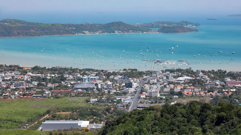
From Ranong past Phuket and down to Trang, islands rise like dragon’s teeth from emerald water. Muslim fishing communities share bays with boutique hideaways; mangroves stitch the shoreline together. It’s the postcard coast, but step sideways and you’ll still find silence.
Gulf of Thailand – The Eastern Calm
Sheltered from the worst monsoon tantrums, Gulf islands are greener, rounder, and easier to orbit. Samui, Phangan, and Tao make a neat hop; Trat’s far-east isles cradle mangroves and quiet piers pointed toward Cambodia.
Eastern & Border Islands
Koh Chang, Koh Kood, and Koh Mak are the “last frontier”—part fishing village, part rainforest, part cloud-watcher’s paradise. Wooden piers, sleepy roads, and water so clear you can count the ripples on the sand below.
The Andaman Sea Islands
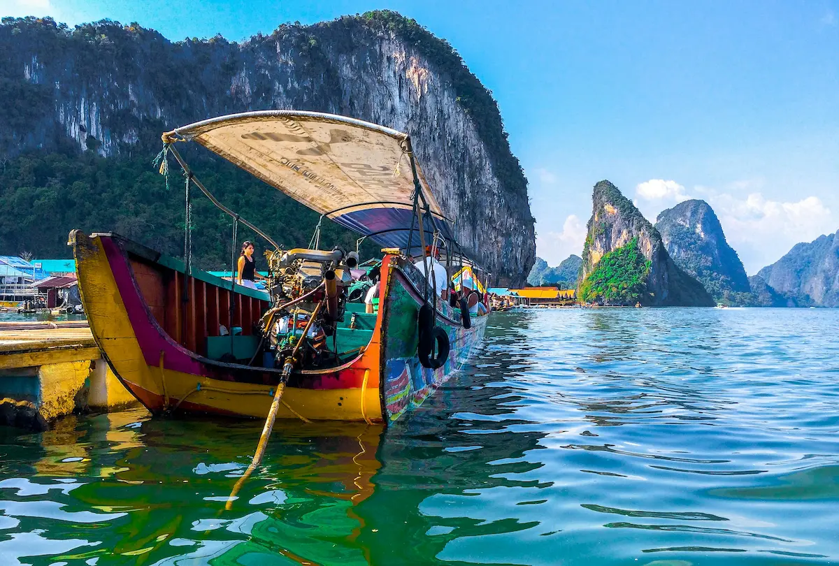
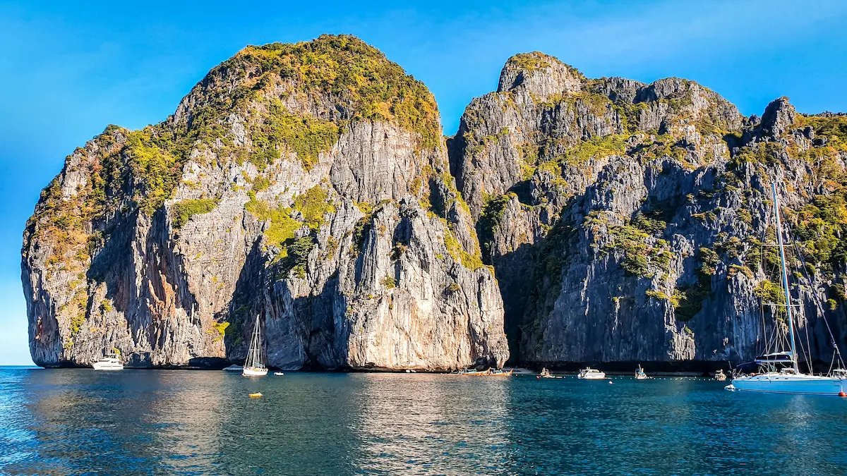
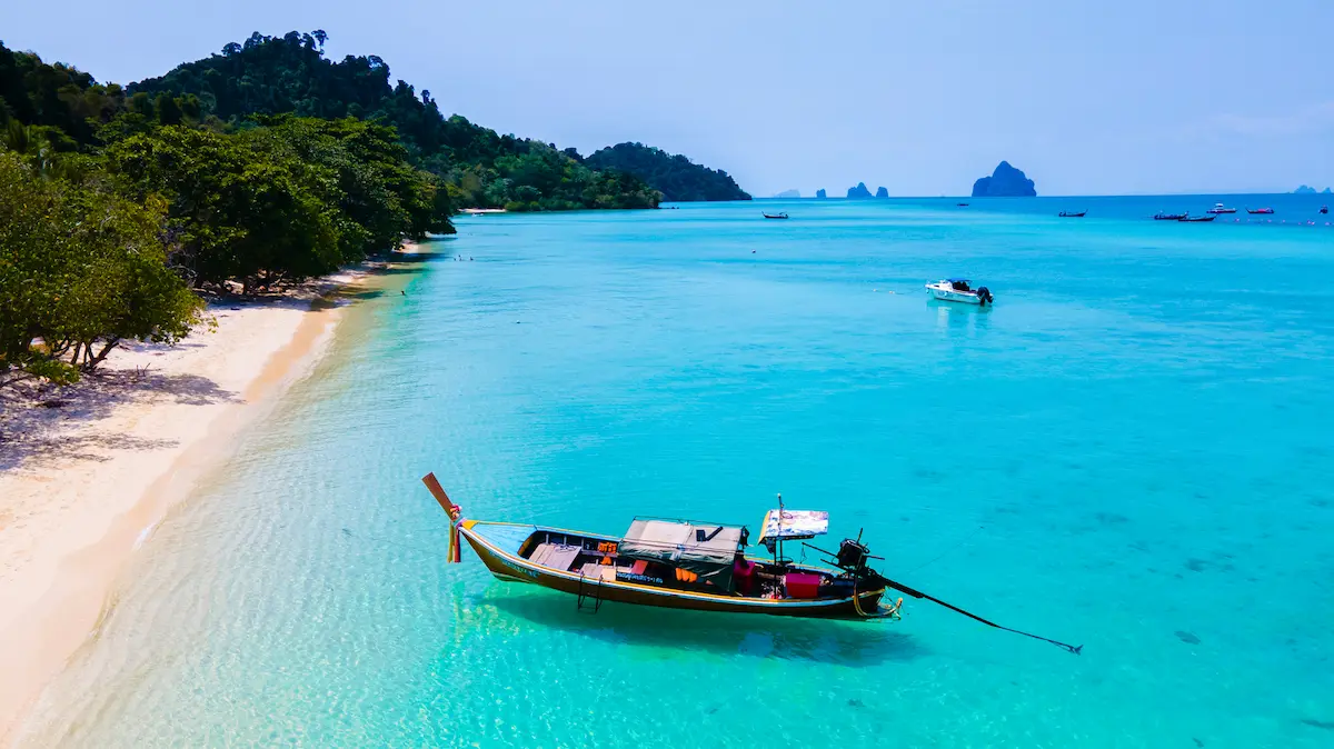
Koh Phi Phi
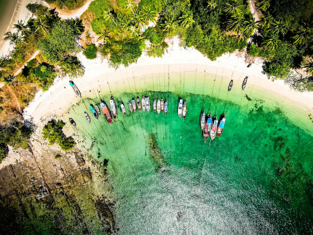
Arriving by boat, the cliffs of Phi Phi Leh seem to rise from another planet—sheer limestone streaked in orange and green, waterfalls stitching down to pockets of pale sand. Boats idle for that first photograph, the one everyone takes yet somehow feels new. On Phi Phi Don, cafés and dive shops hum near the pier; ten minutes inland, coconut groves buzz with cicadas and sandy paths curl to quiet coves where longtails anchor at low tide. A dawn climb to Viewpoint 2 rewards you with the island’s iconic twin-bay curve—two crescents of blue divided by a sliver of white sand. Ferries from Phuket or Krabi take about ninety minutes; staying a night lets you hear the island exhale after day-trippers leave.
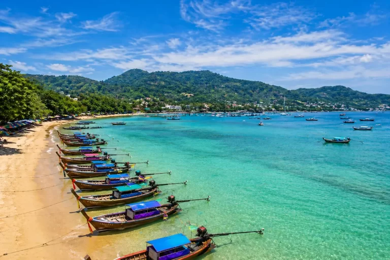
Koh Lanta
Where Phi Phi dazzles, Lanta soothes. A long, slender silhouette fringed by casuarina trees, it unfurls nearly thirty kilometres of beach where there’s always space to breathe. Families play under palms; fishermen mend nets beside beach bars built from driftwood; inland, a national park tucks waterfalls and mangroves beneath hornbill flight paths. In Old Town, teak stilt houses lean over the tide like time travellers from another century. Lanta arrives softly—by passenger boat from Phuket (via Phi Phi) or by short car-ferry from Krabi—and has a knack for making people forget their return ticket.
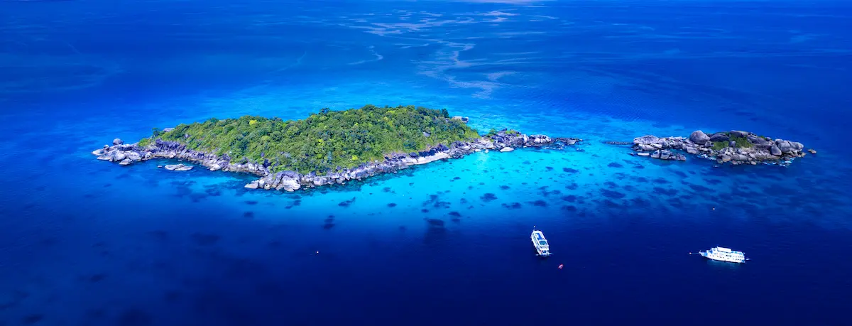
Similan & Surin Islands
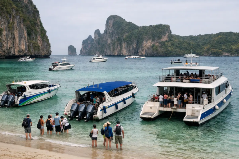
Far offshore, where the sea turns cobalt and the horizon fades, the Similan and Surin archipelagos rise like granite whales from the deep. Beaches glare white enough to glow under moonlight; under the surface, coral gardens detonate with color—parrotfish, manta rays, and sometimes the slow shadow of a whale shark. These marine parks open November through May; liveaboard decks host the brightest stars you’ll see all year. Day boats sail from Khao Lak and Phuket; visibility can hit 30–40 metres, a photographer’s definition of bliss.
Koh Yao Noi & Koh Yao Yai
Halfway between Phuket and Krabi lies the antidote to both. Rice fields mirror the sky between limestone towers; water buffalo outnumber taxis; wooden houses breathe in the shade of frangipani. At dawn, longtails cough gently through mangrove channels while fishermen stack nets in rhythms as old as the tide. Speedboats from Bang Rong (Phuket) or Tha Len (Krabi) reach Yao Noi in half an hour. Come not to escape, but to exhale—mornings of soft mist, afternoons lingering over coconut curries with a view that refuses to be photographed only once.
Photo Tip: Karst cliffs pop at golden hour—reflections off water and rock double the color. Polarizers help; so does slowing down.
The Gulf of Thailand Islands
The Gulf trades drama for ease—calmer crossings, greener hills, and a talent for long afternoons.
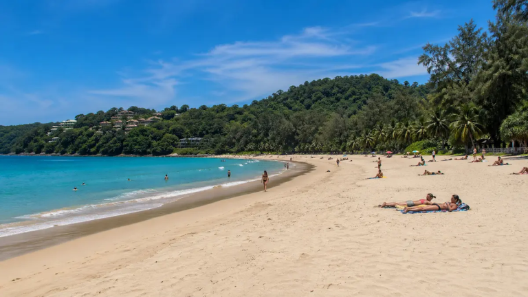
Koh Samui
Samui is both gateway and destination. Coconut palms climb toward hilltop temples and jungle waterfalls; around Chaweng and Lamai, the island hums with cafés roasting local beans and shophouses perfumed with pandan and lime. Drive fifteen minutes and coves appear where the only soundtrack is surf and cicadas. Fisherman’s Village strings fairy lights at dusk; Big Buddha’s gold cools to a soft amber as planes arc in from Bangkok and Singapore. With its airport and broad bed base, Samui is the easy first island that still rewards a curious detour.
Koh Phangan
Long reduced to a party headline, Phangan hides a gentler truth. Mornings unroll yoga mats in jungle shalas; afternoons drift into hammock siestas; evenings gather at Haad Yuan where drums and the last light braid together. A scooter opens the map: dirt tracks to quiet bays, waterfalls behind banana groves, cafés overlooking rust-red coral shelves where fishermen wade with lanterns at dusk. Arrive by ferry from Samui or Surat Thani and stay long enough for your pulse to sync with the island’s.
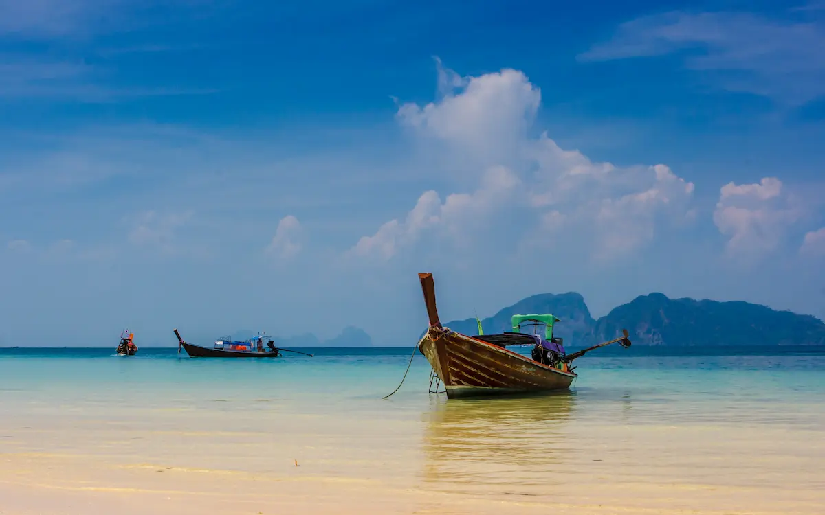
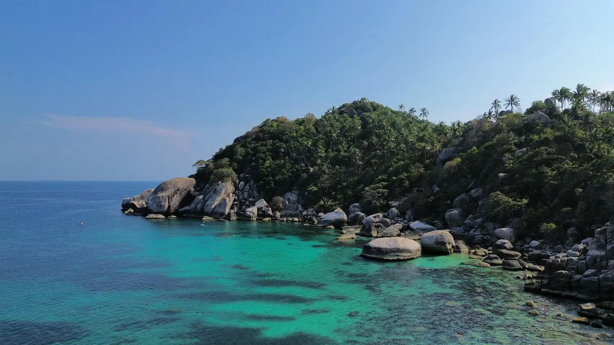
Koh Tao
A granite jewel barely eight kilometres long, Tao is where cliffs tumble into reefs humming with butterflyfish. Many come to learn to dive and then remain for the hush—nights of grilled snapper and soft guitars by the sand. Viewpoints like John Suwan and Love Koh Tao pull a gradient of blues across the lens; snorkelers slip into water straight from the beach; whale sharks glide by in late summer as if to check your buoyancy. Regular ferries link Chumphon, Samui, and Phangan; leave time for a second sunrise—you’ll want it.
When to Visit – Seasons & Weather
| Season | Andaman Sea | Gulf of Thailand | Notes |
|---|---|---|---|
| Nov – Apr | Dry & sunny | Warm & calm | Peak season; best visibility |
| May – Oct | Monsoon rains | Generally fair | Lower prices; lush landscapes |
| Jul – Aug | Variable | Prime diving months | Check ferries before travel |
Rule of thumb: when storms close Similan, the Gulf is calm—and vice versa. Somewhere in Thailand, the sun is working overtime.
Travel & Photography Tips
Getting Around
Ferries knit the coasts together: Phuket → Phi Phi → Lanta → Trang in the Andaman; Chumphon → Tao → Phangan → Samui in the Gulf. Private longtails and speedboats give photographers the freedom to chase light (best Nov–Apr offshore). Flights land at Phuket, Krabi, Surat Thani, Trat, and Ranong—use them as springboards for multi-island loops.
Budget & Sustainability
- Mid-range ~40–60 USD/day; luxury 250+ USD. Cash helps on small isles.
- Choose reef-safe operators; never stand on coral; avoid anchors in shallow seagrass.
- Carry a refill bottle—eco stations are common and the ocean will thank you.
Photography Essentials
- Golden hour: 6–7 am & 5–6 pm for mirror-calm water and warm rock tones.
- Lenses: 24–70 for landscapes, 70–200 for compressing cliffs; a drone for scale.
- Compose with life: longtails, palm fronds, and mangrove roots add depth.
- Afterglow: keep shooting ten minutes post-sunset—the pastels peak late.
Local Etiquette
Villages appreciate modest dress, shoes off indoors, and a few Thai phrases—sawatdee (hello), khop khun krap/ka (thank you). Beach shrines deserve the same respect you give the sea.
Frequently Asked Questions
How were Thailand’s islands formed?
Through millions of years of coral deposition, plate collision, uplift, and erosion—turning ancient reefs into limestone cliffs and granite islets.
How many islands does Thailand have?
Official counts list over 1,400, though only around a hundred are inhabited or easily accessible.
Which island has the clearest water?
The Similan Islands and Koh Tachai often reach 30–40 m visibility. In the Gulf, Koh Kradan is renowned for clarity.
What are the least-crowded islands?
Koh Phra Thong, Koh Bulon Leh, and parts of Koh Mak remain peaceful even during high season.
Which islands are best for photographers?
Phi Phi for drama, Yao Noi for cultural landscapes, Koh Kood for rainforest beaches, and Similan for underwater color.
Is inter-island travel expensive?
Ferries average 300–600 THB (≈ $9–18). Private speedboats cost more but can save significant time.
Do I need a visa?
Many nationalities receive a 30–60-day entry; always check official updates before travel.
Conclusion & Next Steps
To walk Thailand’s islands is to walk through time—coral becoming stone, stone turning back to sand. The Andaman stirs with cliffs that glow like embers at sunset; the Gulf soothes with long horizons that teach you to breathe again. The best journeys thread both—days of cliff light and mangrove shade, ferries and footpaths, conversations with boatmen who read the wind like a book.
Go lightly, tip generously, and keep one eye on the tide chart and the other on the sky. For every famous bay, there’s a quiet headland around the corner with your name written in foam.
If this Thailand Islands Guide was helpful please leave us a comment or let us know what else yuo would like to see included for the 2026 edition.
คู่มือครบถ้วนเกาะต่างๆ ของประเทศไทย (ฉบับปี 2025)
สำรวจหมู่เกาะของประเทศไทย ตั้งแต่กำเนิดเมื่อหลายร้อยล้านปีก่อน จนถึงเกาะยอดนิยมและเกาะลับสุดน่าหลงใหลในปัจจุบัน คู่มือฉบับปี 2025 ที่จะพาไปรู้จักเสน่ห์ของทะเลอันดามันและอ่าวไทยอย่างครบถ้วน
จุดเริ่มต้นของสวรรค์แห่งนี้
นานมาแล้วก่อนที่นักเดินทางจะมาพร้อมกล้องและค็อกเทล หมู่เกาะของประเทศไทยได้เริ่มก่อตัวขึ้นใต้มหาสมุทรโบราณ เมื่อประมาณ 500 ล้านปีก่อน ปะการังเติบโตเต็มทะเลอุ่น แล้วแข็งตัวกลายเป็นหินปูน ถูกผลักขึ้นสู่ผิวน้ำจากการชนกันของแผ่นเปลือกโลก และถูกฝนลมกัดเซาะจนกลายเป็นหน้าผาหินปูนสูงตระหง่านกลางน้ำสีมรกตอย่างที่เราเห็นทุกวันนี้
ทุกเกาะในประเทศไทยคือชิ้นส่วนของเรื่องราวธรรมชาติที่สวยงามและซับซ้อน วันนี้พื้นที่เหล่านั้นกลายเป็นหมู่บ้านชาวประมง โยคะรีทรีต สตูดิโอนักดิจิทัล และสวรรค์ของคู่รักที่มาฮันนีมูน แต่ไม่ว่าคุณจะมาในแบบไหน เกาะไทยก็มีจังหวะและแสงของตัวเองให้คุณหลงรักเสมอ
คู่มือหมู่เกาะประเทศไทย ฉบับปี 2025 เล่มนี้จะพาคุณไล่ดูตั้งแต่ต้นกำเนิดทางธรณีวิทยา จนถึงการเดินทางในยุคใหม่ พร้อมคำแนะนำจริงจากประสบการณ์ตรง ทั้งเส้นทางเดินทาง จุดที่ควรไป และมุมสงบที่ยังคงความงามบริสุทธิ์ไว้ได้อย่างน่าทึ่ง
กำเนิดหมู่เกาะของประเทศไทย
ชายฝั่งทะเลของประเทศไทยตั้งอยู่บนรอยต่อของแผ่นเปลือกโลกโบราณสองแผ่น ที่ค่อยๆ ชนและยกตัวขึ้นตลอดหลายร้อยล้านปี จนกลายเป็นภูมิประเทศที่สวยงามที่สุดแห่งหนึ่งของเอเชียตะวันออกเฉียงใต้
| ช่วงเวลา | เหตุการณ์ | ผลลัพธ์ |
|---|---|---|
| ประมาณ 500 ล้านปีก่อน | พื้นที่ทั้งหมดอยู่ใต้มหาสมุทรเททิส (Tethys Ocean) | ตะกอนทะเลและปะการังสะสมตัวหนาแน่น |
| ประมาณ 250 ล้านปีก่อน | แผ่นเปลือกโลกอินเดียและยูเรเซียชนกัน | แนวปะการังถูกยกตัวขึ้นเป็นภูเขาหินปูน |
| ประมาณ 65 ล้านปีก่อน | การกัดเซาะและระดับน้ำทะเลเปลี่ยนแปลง | เกิดอ่าว ถ้ำ และหน้าผารูปทรงแปลกตา |
| ปัจจุบัน | แนวปะการังใหม่เกิดขึ้นรอบหินเก่า | แหล่งดำน้ำและอุทยานทางทะเลมากมาย |
ฝั่งอันดามัน มีภูเขาหินปูนสูงตระหง่าน เกิดจากแนวปะการังที่ถูกยกขึ้น ส่วน ฝั่งอ่าวไทย จะเป็นหินแกรนิตและหินทรายที่เก่าแก่กว่า — โครงสร้างต่างกันแต่มหัศจรรย์ไม่แพ้กัน
หมู่เกาะหลักของประเทศไทย
ประเทศไทยมีเกาะมากกว่า 1,400 เกาะ แบ่งได้เป็นสามกลุ่มใหญ่ แต่ละกลุ่มมีเอกลักษณ์ทางธรรมชาติและวัฒนธรรมที่ต่างกันชัดเจน
ฝั่งทะเลอันดามัน – เวทีธรรมชาติทางตะวันตก
ตั้งแต่ระนองลงมาถึงตรัง เกาะฝั่งนี้คือสวรรค์ของหินปูนและน้ำสีมรกต หมู่บ้านมุสลิมตั้งอยู่เคียงข้างรีสอร์ตหรู มีทั้งป่าชายเลนที่สมบูรณ์และแนวปะการังที่เต็มไปด้วยชีวิต ใครชอบวิวแบบโปสการ์ดต้องห้ามพลาดฝั่งนี้
ฝั่งอ่าวไทย – ทะเลที่สงบและอบอุ่น
น้ำทะเลนิ่งและคลื่นอ่อนกว่า เหมาะกับการพักผ่อนยาวๆ เกาะสมุย พะงัน และเต่าเชื่อมต่อกันด้วยเรือเฟอร์รี่สะดวกสบาย ส่วนหมู่เกาะตราดอย่างเกาะช้างและเกาะกูดก็ขึ้นชื่อเรื่องความเงียบสงบและธรรมชาติสมบูรณ์
หมู่เกาะตะวันออกและชายแดน
เกาะช้าง เกาะกูด และเกาะหมาก ถือเป็น “แนวหน้าสุดท้าย” ของทะเลตะวันออก หมู่บ้านประมงไม้เก่า ถนนเล็กๆ ร่มรื่น และน้ำใสจนมองเห็นเงาคลื่นสะท้อนใต้ผิวน้ำอย่างชัดเจน
หมู่เกาะฝั่งทะเลอันดามัน
ฝั่งอันดามันคือเวทีธรรมชาติที่ยิ่งใหญ่ของประเทศไทย หน้าผาหินปูนสูงตระหง่าน ทะเลสาบซ่อนตัว และอุทยานทางทะเลที่งดงามราวภาพวาด บางเกาะคึกคักแต่บางเกาะก็เงียบสงบจนได้ยินเพียงเสียงลมกับคลื่น
เกาะพีพี
เมื่อเรือแล่นเข้าใกล้เกาะพีพีเล หน้าผาหินปูนสีส้มเขียวตัดกับน้ำทะเลฟ้าครามเหมือนหลุดไปอีกโลกหนึ่ง เรือหางยาวลอยนิ่งให้คนถ่ายภาพมุมเดิมแต่ไม่มีวันซ้ำ ที่เกาะพีพีดอนมีคาเฟ่ ร้านดำน้ำ และร้านอาหารมากมาย แต่แค่เดินออกจากท่าเรือไม่กี่นาทีก็จะเจอทางเดินเล็กๆ ผ่านสวนมะพร้าวไปยังอ่าวเงียบที่คนไม่พลุกพล่าน จุดชมวิวพีพีวิวพอยท์ 2 คือมุมมหาชนที่เห็นอ่าวโค้งคู่สีฟ้าสวยสะกดตา เรือเฟอร์รี่มาจากภูเก็ตหรือกระบี่ใช้เวลาราว 90 นาที ถ้ามีเวลา พักค้างคืนสักคืนแล้วคุณจะได้ยินเสียงทะเลจริงๆ หลังนักท่องเที่ยวกลับหมด
เกาะลันตา
เกาะลันตาให้ความรู้สึกสงบเย็นเหมือนชื่อ เส้นทางยาวเรียบชายหาดเกือบ 30 กิโลเมตร มีทั้งหมู่บ้านชาวประมง คาเฟ่ไม้ และบาร์ริมทะเลที่ตกแต่งจากเศษไม้ลอยน้ำ ในตัวเมืองเก่า บ้านไม้สักหลังเก่าๆ ยื่นออกไปในทะเลเหมือนหลงยุค ภายในเกาะยังมีอุทยานแห่งชาติที่เต็มไปด้วยน้ำตก ป่าชายเลน และนกเงือกให้ชม การเดินทางมาลันตาสะดวก ทั้งทางเรือจากภูเก็ตหรือเฟอร์รี่ข้ามฟากจากกระบี่
หมู่เกาะสิมิลันและสุรินทร์
ถ้าอยากเห็นทะเลสีฟ้าเข้มจนขอบฟ้าหายไป ต้องมาที่หมู่เกาะสิมิลันและสุรินทร์ หาดทรายขาวราวกระจก น้ำใสจนเห็นเงาปลาใต้ผิวน้ำ ดำน้ำจะเจอปะการังหลากสี ปลากระเบนราหู และบางวันอาจเจอฉลามวาฬลอยผ่าน หมู่เกาะนี้เปิดเฉพาะช่วงพฤศจิกายนถึงพฤษภาคม เดินทางจากเขาหลักหรือภูเก็ตได้ง่าย เหมาะสุดสำหรับคนชอบดำน้ำหรือถ่ายภาพใต้น้ำ
เกาะยาวน้อยและเกาะยาวใหญ่
อยู่กึ่งกลางระหว่างภูเก็ตกับกระบี่ เกาะยาวน้อยคือยาชูกำลังของคนที่อยากพักใจ ทุ่งนาเขียวขจีตัดกับภูเขาหินปูน น้ำขึ้นน้ำลงช้าๆ และควายน้ำเดินข้ามถนนอย่างสงบ ที่นี่ไม่มีห้าง ไม่มีผับใหญ่ มีแต่เสียงคลื่นและรอยยิ้มจริงใจจากชาวบ้าน ใช้เวลาเพียงครึ่งชั่วโมงจากท่าเรือบางโรงหรือท่าเรือท่าเลน ก็ถึงโลกอีกใบที่เวลาเดินช้าลงอย่างน่าอัศจรรย์
📸 เคล็ดลับการถ่ายภาพ: ถ่ายหน้าผาหินปูนช่วงแสงทองยามเย็นจะได้สีเข้มคอนทราสต์สวย ใช้ฟิลเตอร์โพลาไรซ์ช่วยลดแสงสะท้อนจากน้ำ
หมู่เกาะฝั่งอ่าวไทย
ฝั่งอ่าวไทยเป็นอีกด้านของความงาม — ทะเลเรียบสงบ คลื่นอ่อน และแสงแดดนุ่มนวล เหมาะกับการพักผ่อนยาวๆ และการเดินทางแบบสบายใจ
เกาะสมุย
เกาะสมุยเป็นทั้งประตูและจุดหมายของนักเดินทาง ต้นมะพร้าวสูงเรียงรายตลอดทางขึ้นเขา วัดบนยอดดอยมองเห็นวิวทะเลสุดสายตา ย่านเฉวงและละไมเต็มไปด้วยคาเฟ่ กลิ่นกาแฟคั่วหอมๆ ลอยมาตามลม แต่ขับรถออกไปแค่สิบห้านาทีก็จะเจออ่าวเล็กๆ เงียบสงบที่มีเพียงเสียงคลื่นกับจักจั่น “หมู่บ้านชาวประมง” สวยที่สุดตอนเย็นเมื่อไฟระยิบระยับทั่วถนน ส่วน “พระใหญ่” สีทองจะเปลี่ยนเป็นสีอำพันเมื่อแสงอาทิตย์ใกล้ตกดิน เดินทางมาง่ายด้วยเครื่องบินตรงจากกรุงเทพฯ เชียงใหม่ หรือสิงคโปร์ เหมาะสุดสำหรับมือใหม่ที่อยากสัมผัสทะเลไทย
เกาะพะงัน
แม้ชื่อเสียงของเกาะพะงันจะมาพร้อมงานฟูลมูนปาร์ตี้ แต่เกาะนี้มีอีกด้านที่สงบและน่ารักกว่ามาก ตอนเช้าผู้คนม้วนเสื่อโยคะในศาลากลางป่า ตอนบ่ายนอนอ่านหนังสือบนเปลญวน และตอนเย็นจะได้ยินเสียงกลองและเสียงหัวเราะริมชายหาดหาดยวน ถ้าเช่ามอเตอร์ไซค์จะได้เห็นเกาะในมุมใหม่ๆ ทั้งน้ำตก คาเฟ่วิวปะการัง และอ่าวเล็กๆ ที่ต้องขับผ่านสวนกล้วยถึงจะเจอ เรือมาจากสมุยหรือสุราษฎร์ธานี ใช้เวลาไม่กี่ชั่วโมง แต่ความสงบของเกาะนี้จะทำให้คุณอยากอยู่นานกว่านั้นแน่นอน
เกาะเต่า
เกาะเล็กๆ ยาวเพียงแปดกิโลเมตรแห่งนี้คือสวรรค์ของคนรักการดำน้ำ หน้าผาหินแกรนิตโอบล้อมแนวปะการังที่มีปลาผีเสื้อและปลานกแก้วว่ายวน ใครอยากเรียนดำน้ำราคาประหยัดที่นี่คือที่หนึ่งในเอเชีย บรรยากาศยามค่ำมีทั้งร้านอาหารริมทะเลและดนตรีสดเบาๆ จุดชมวิวอย่าง “จอห์นสุวรรณ” หรือ “เลิฟเกาะเต่า” เป็นจุดถ่ายภาพยอดนิยม ส่วนเดือนมีนาคมถึงมิถุนายนคือช่วงที่มีโอกาสเห็นฉลามวาฬ เรือเฟอร์รี่มีบริการจากชุมพร สมุย และพะงันทุกวัน
ช่วงเวลาที่เหมาะกับการท่องเที่ยว
| ฤดูกาล | ฝั่งอันดามัน | ฝั่งอ่าวไทย | หมายเหตุ |
|---|---|---|---|
| พฤศจิกายน – เมษายน | แดดจัด ฟ้าใส | ทะเลเรียบ คลื่นอ่อน | ฤดูท่องเที่ยวหลัก เหมาะกับดำน้ำ |
| พฤษภาคม – ตุลาคม | ฝนตกบ้างเป็นช่วงๆ | อากาศดีโดยรวม | ราคาที่พักถูกลง ธรรมชาติเขียวชอุ่ม |
| กรกฎาคม – สิงหาคม | สภาพอากาศแปรปรวน | น้ำใสเหมาะดำน้ำ | ควรเช็คตารางเรือก่อนเดินทาง |
เคล็ดลับ: ถ้าฝั่งอันดามันมีพายุ ฝั่งอ่าวไทยมักจะอากาศดีเสมอ ที่ประเทศไทยจะมีฟ้าสวยอยู่สักฝั่งแน่นอน
เคล็ดลับการเดินทางและถ่ายภาพ
การเดินทางระหว่างเกาะ
เรือเฟอร์รี่เชื่อมต่อระหว่างเกาะอย่างสะดวก เช่น ภูเก็ต → พีพี → ลันตา → ตรัง สำหรับฝั่งอันดามัน และ ชุมพร → เต่า → พะงัน → สมุย สำหรับฝั่งอ่าวไทย ส่วนเครื่องบินมีสนามบินหลักที่ภูเก็ต กระบี่ สุราษฎร์ธานี ตราด และระนอง ใช้เป็นจุดเริ่มต้นดีมากสำหรับการเดินทางแบบหลายเกาะ
งบประมาณและความยั่งยืน
- งบกลางวันละ 1,500–2,500 บาท ที่พักหรูเริ่มราว 8,000 บาทขึ้นไป (ควรพกเงินสดติดตัวโดยเฉพาะเกาะเล็ก)
- เลือกผู้ให้บริการดำน้ำที่ใช้ครีมกันแดดแบบ reef safe และไม่ทิ้งสมอในแนวหญ้าทะเล
- พกขวดน้ำแบบรีฟิล ลดขยะพลาสติก ตอนนี้มีจุดเติมน้ำสะอาดหลายแห่งทั่วเกาะยอดนิยม
เทคนิคถ่ายภาพทะเล
- ช่วงแสงทอง: 6–7 โมงเช้าและ 5–6 โมงเย็น น้ำจะนิ่ง สีจะอบอุ่น เหมาะกับภาพสะท้อน
- เลนส์แนะนำ: 24–70 มม. สำหรับวิวกว้าง 70–200 มม. สำหรับหน้าผา หรือ โดรน เพื่อเก็บมุมสูง
- องค์ประกอบภาพ: ใช้เรือหางยาว ต้นมะพร้าว หรือรากโกงกางเป็นกรอบภาพธรรมชาติ
- หลังพระอาทิตย์ตก: ถ่ายต่ออีก 10 นาที จะได้โทนพาสเทลหวานๆ บนผิวน้ำ
มารยาทท้องถิ่น
ในหมู่บ้านควรแต่งกายสุภาพ ถอดรองเท้าก่อนเข้าบ้านหรือวัด พูดคำง่ายๆ อย่าง สวัสดี / ขอบคุณครับ / ขอบคุณค่ะ คนท้องถิ่นจะยิ้มตอบอย่างอบอุ่น อย่าลืมเคารพศาลเล็กๆ ตามชายหาด ซึ่งชาวประมงเชื่อว่าเป็นที่สิงสถิตของวิญญาณผู้ปกป้องทะเล
สรุปส่งท้าย
การเดินบนเกาะของประเทศไทยคือการเดินย้อนเวลา — จากปะการังสู่หิน จากหินกลับเป็นทรายอีกครั้ง ฝั่งอันดามันคือความยิ่งใหญ่ของธรรมชาติ ส่วนฝั่งอ่าวไทยคือความอ่อนโยนของแสงและลม ถ้าได้เที่ยวทั้งสองฝั่ง คุณจะเข้าใจว่าทำไมคนถึงหลงทะเลไทยไม่รู้จบ
เดินทางอย่างเบา เคารพชุมชน และเงี่ยหูฟังเสียงคลื่นให้มากกว่าคลื่นใจ เพราะทุกโค้งของอ่าวยังมีชายหาดเล็กๆ ที่รอให้คุณค้นพบด้วยตัวเอง

เกี่ยวกับผู้เขียน
Dave Hibbins ช่างภาพและนักเขียนท่องเที่ยว ผู้ก่อตั้ง Go Find Asia เดินทางสำรวจเกาะต่างๆ ทั่วไทยและเนปาล เพื่อเล่าเรื่องวัฒนธรรมและแสงสวยผ่านภาพถ่าย
Good information